Now, hypermedia is basically mainstream. Students and teachers, along with almost everyone connected to the internet, uses the world wide web on a daily basis. We are used to having an incredible array of interconnected knowledge at our fingertips.
| The city of Dresden |
Google Earth is a wonderfully ambitious platform. It attempts to document the world as it actually is, both in 2 and 3 dimensions. It then superimposes information: building names, stores, streets, natural landmarks, on top of the image. Google Earth has even developed ways for students to create "tours" and move around the world. Students can create their own labels, or "nodes," of information, tagged at appropriate places. Even more recently, Google Earth has allowed users to create fictional or historical buildings and cities.
Part of what makes Google Earth such an effective and widely used example of hypermedia is that its mission and flexibility is so broad. It really attempts to map the entire earth. It then lets the user utilize that map and tag information that he or she deems appropriate. You can use the application for geography, literature, art, history, or science. Because it is so successful in creating an accurate representation of the world, using it is almost like not looking at a computer at all, but playing with reality.
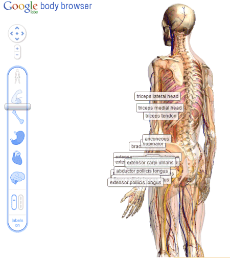 |
| Body Browser from Google |
Adding information to a realistic, but flexible image is one of the great attributes of Google Earth and BodyBrowser. Students can see how different organs and systems interact within the human body, but they can also explore, almost as if they are going into a cadaver, but anything they click on can bring more information to the screen. It would be a very powerful tool for biology students to go and explore, report back their findings, and then to discuss the disagreements or issues that students found. BodyBrowser is complete discovery, complete freedom of information within the human body.
There are other ways to give students a basic blank canvas, and ask them to create their own content and structure on top of it. Inspiration Maps is an example of a solid product that allows students to use Ipads and the like to create their own maps.
With Inspiration Maps one could create a pretty similar product to what Jonassen describes in the second half of his piece. However, it's important to note that this really is a blank canvas. The students have freedom to create their own "hyper" information system, but they would have to create everything themselves. I believe the power of Google Earth and Google BodyBrowser, is that they create a visual template for the students to explore and then add to them.
I'm not sure that in 1996 we could invision that a company would map out the entire Earth or human body. But now we have enormous resources for our kids to use and then augment to meet their learning needs and to show their understanding of a subject.
No comments:
Post a Comment